Trip Tracker!

On track for improvment

Posted by Sarah Wilson on 19th April 2020

Trip Tracker - On track for improvement

This is a follow on article about how I improved this project. If you want to read how it was made then check this out Trip Tracker - the start of the voyage

As a recap, I know my camera captures GPS data on my photos and I know if I google this, google maps can show me where the photo was taken.
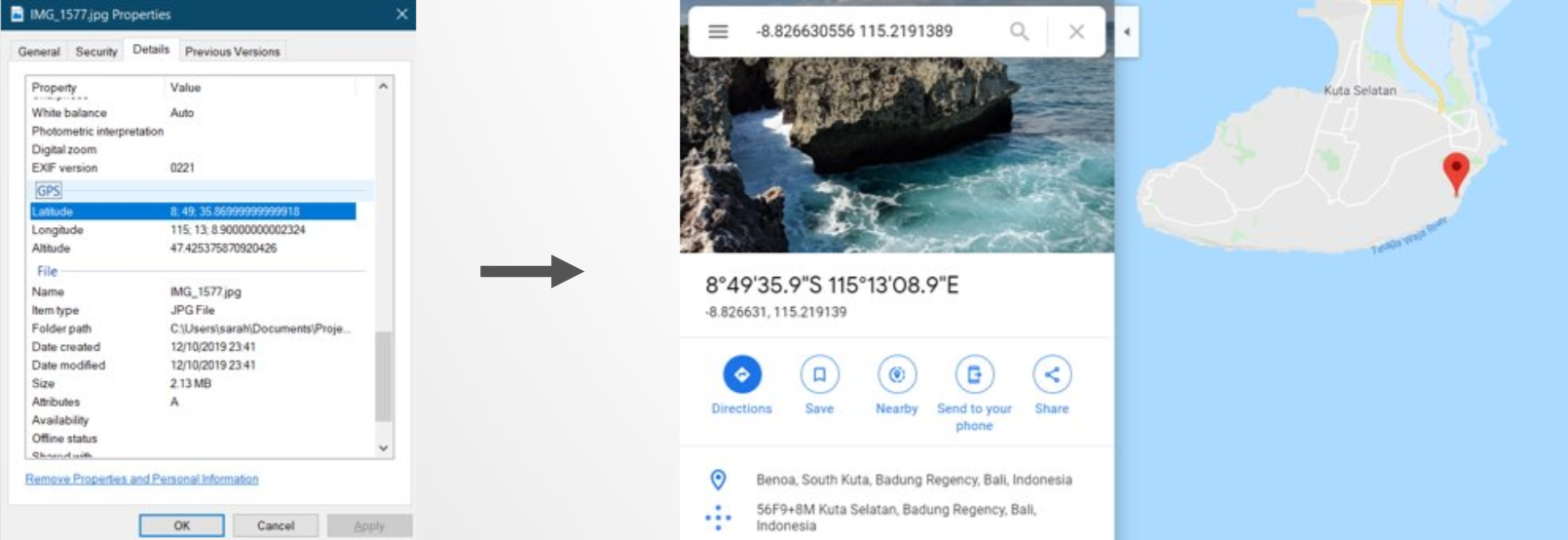
Example GPS

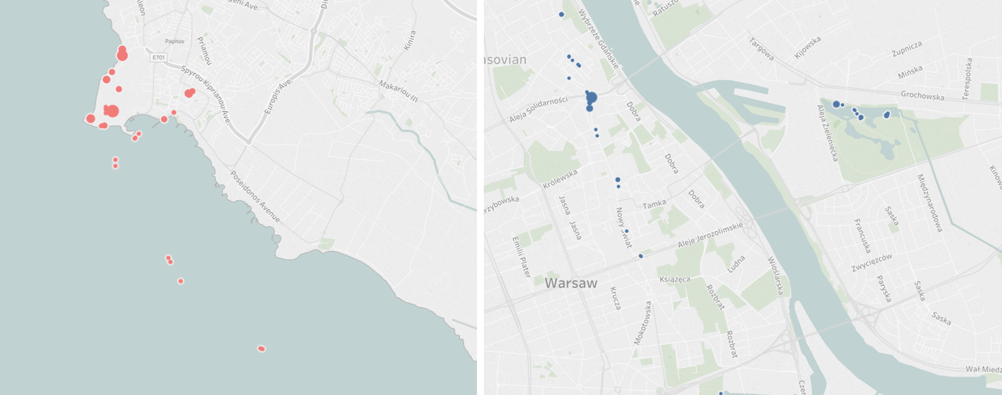
After a bit of a struggle, in September 2018 I end up with something that looks like this:
map
Left is the West coast of Cyprus and right is Warsaw in Poland.

April 2019 and it is nearly 7 months since I have looked at my code or updated this website. This causes me many issues...

  • I can't even remember what software I used to my write my code and I have several possible programs installed on this computer from experiementing over the years.
  • I ended up writing the code where I stored the python packages (C:\Python27\Lib\site-packages\GPSPhoto) because it didn’t work otherwise and I wanted to get it working more than I cared about where it was stored. When I eventually run my code I can't find the new results.
  • I am still having to manually tidy up the Excel output and I have to re-learn how to set up the Tableau file.
  • I am just generally a bit disorentated and the documentation I left myself is not helping much.

Despite this, around midnight (on a work night!) I finally update this website. The actual visible changes are minor, so lets call it V1.1
So I've been on holiday

September 2019 (I apparently only code in September and April) and I've returned from a lovely holiday and I want to update my tracker.

However, it has been 5 months since I have looked at my code or updated this website. You would think I learnt from last time but I have new problems...

  • I have a new laptop, so everything needs setting back up from scratch. Gahhh
  • I wrote my code in python 2.7 and need to upgrade it to python 3.0 because it stops being supported in a few months. I end up getting help trying to use virtual enviroments because computers apparently don't like multiple versions of python on the same machine and the commands I'm using don't work in powershell- I'll not go into it.
  • The new python version isn't compatible with some of my code packages, so just assume at least an hour disappeared into troubleshooting that.

We good? Nope. Out of 1,600 new photos only 35 of them are working.

code tool

It would be useful to have the filenames so I can see which ones are and are not working, but my code doesn't include it. So I figure out how to get file names by reading the code packages, googling and trial and error.

The positive side of this, is that I added lots more information to my output, including a timestamp of when the photo was taken.

I find the source of my problem is the file type. My new iPhone takes High Efficiency Image Format (HEIC). This isn't suppoorted by the python package that I use to extract data.

I am going to gloss over the hours of suffering discovery and say that I eventually got a command line tool to convert my photos into a useable file type and re-loaded them into a new Tableau. All I needed was the following:

code tool

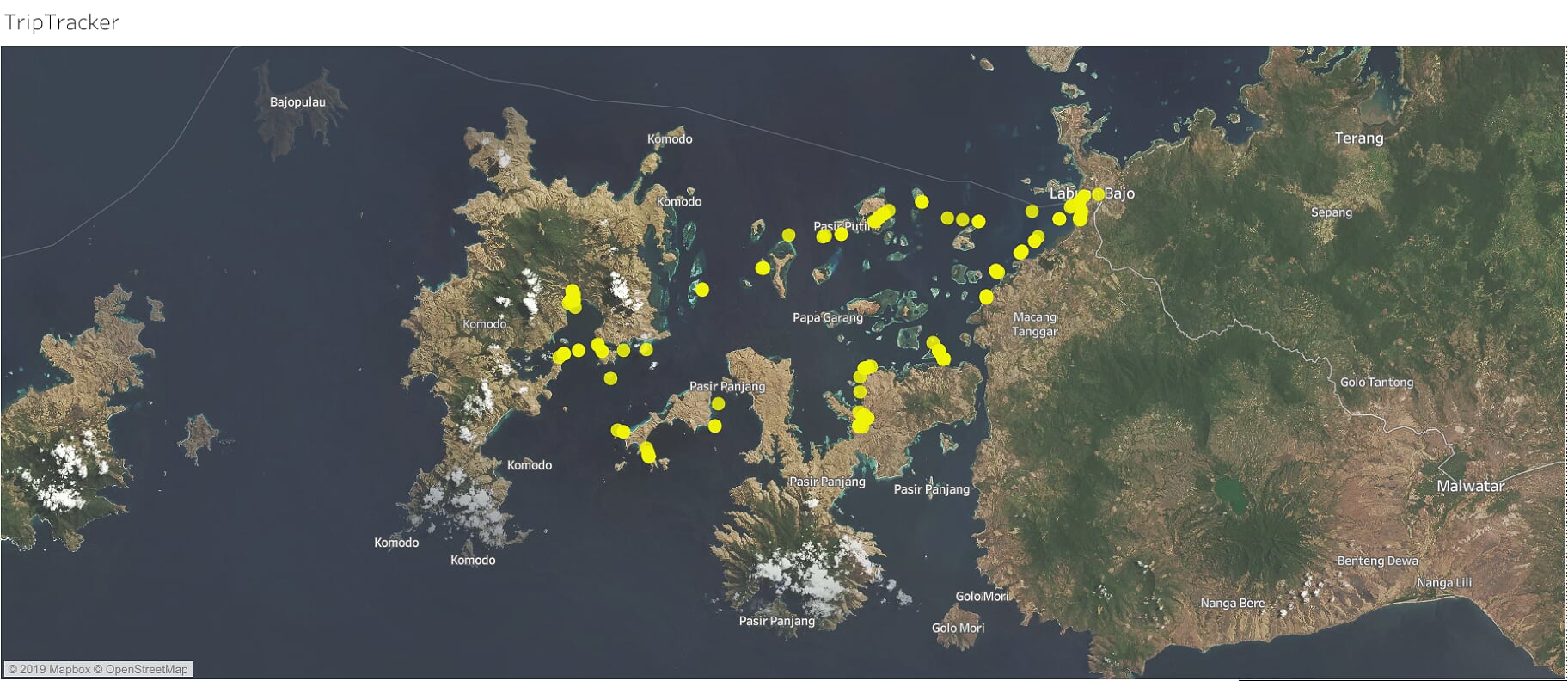
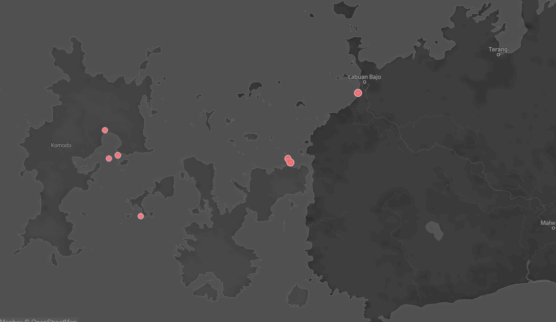
I played around more in Tableau and it now looks like:

map
Flores and Komodo National park in Indonesia

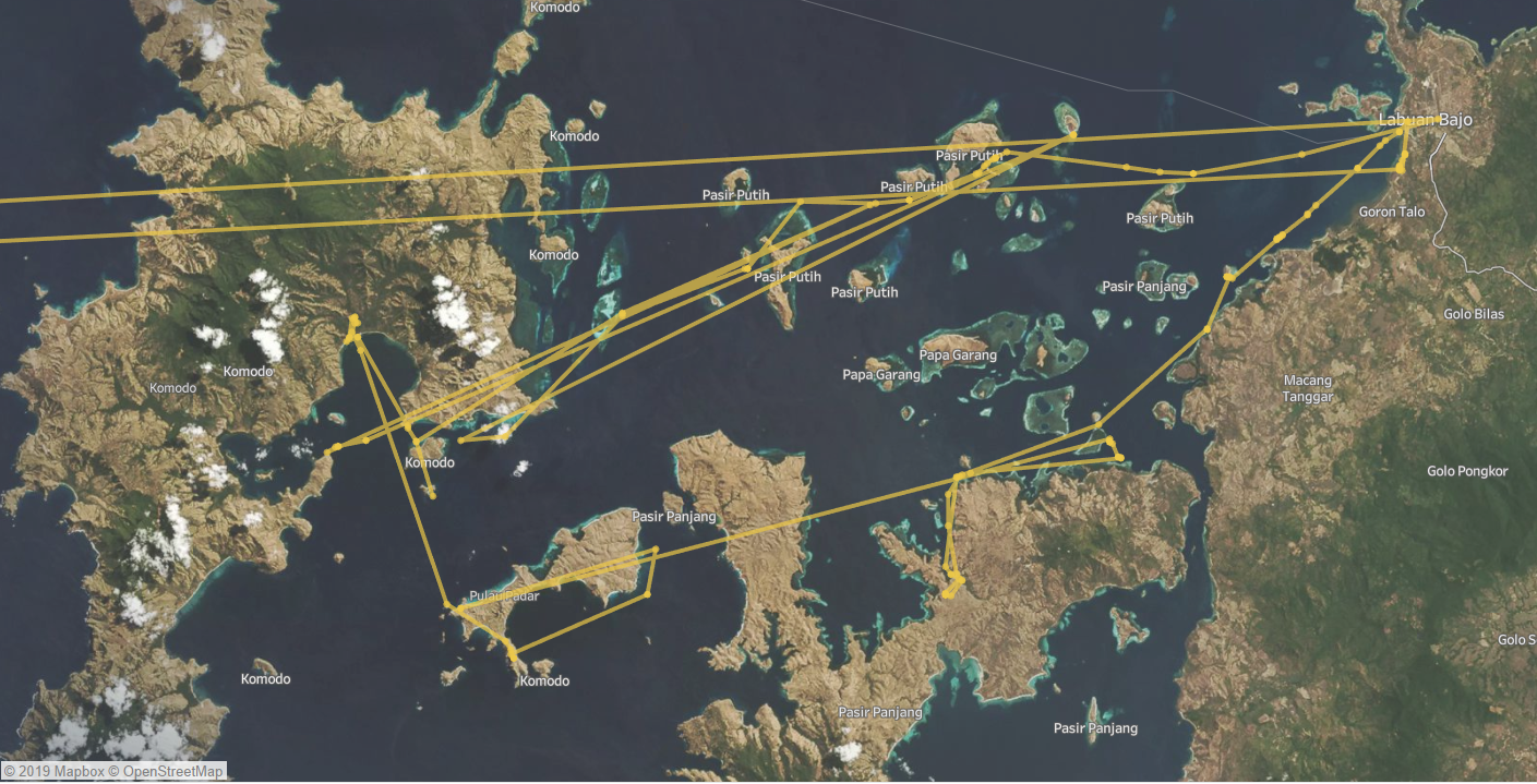
Because I have the timestamp of when the photo was taken, I tried adding lines to show the path. You can see where I flew into Labuan Bajo and went clockwise around the islands, but I think there are some small errors.

map
Flores and Komodo National park in Indonesia with lines

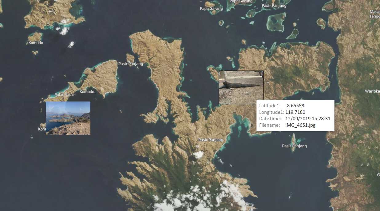
I also tried to add thumbnail photos to the points but that is so much effort I stopped.

map
Flores and Komodo National park in Indonesia with thumbnail images

I'm going to call this V2, but I don't know where I will take this next. There is a reasonable amount of effort just maintain this but it is a nice twice-a-year time sink.

For now, enjoy a timelapse:

Sunrise into Singapore